Seattle weather: Showers return later Thursday
SEATTLE - It was a wet day for Western Washington as our first fall frontal system moved through Wednesday.
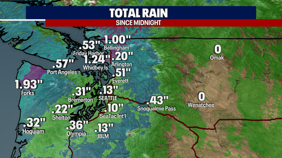
It was a wet day for Western Washington as our first fall frontal system moved through Wednesday.
Today's temperatures were much cooler with highs only in the mid 60s. Many spots were almost 10 degrees cooler this afternoon.
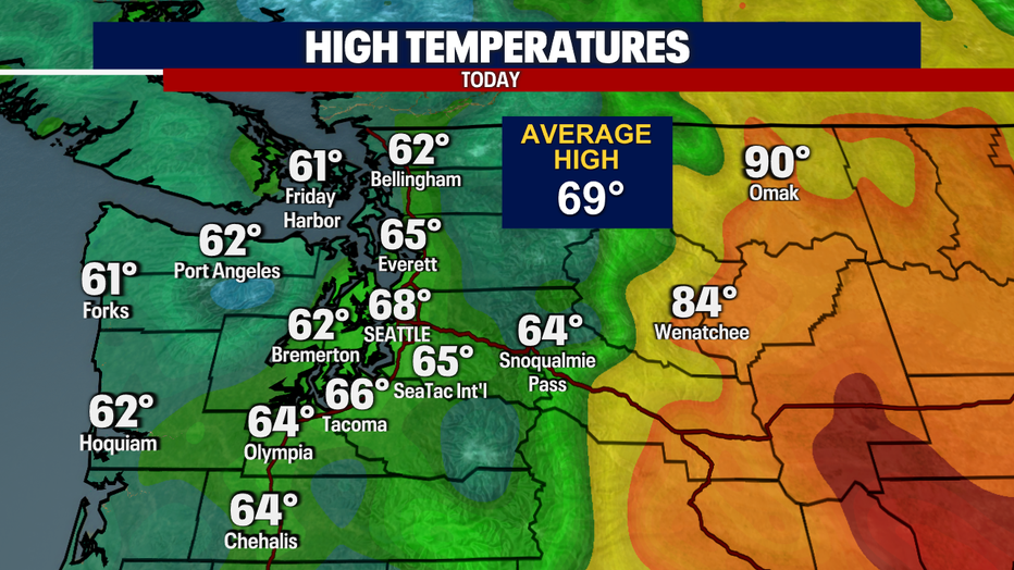
Today's temperatures were much cooler with highs only in the mid 60s. Many spots were almost 10 degrees cooler this afternoon.
Showers will taper overnight with mostly cloudy skies and cooler temperatures, lows in the upper 40s to low 50s.
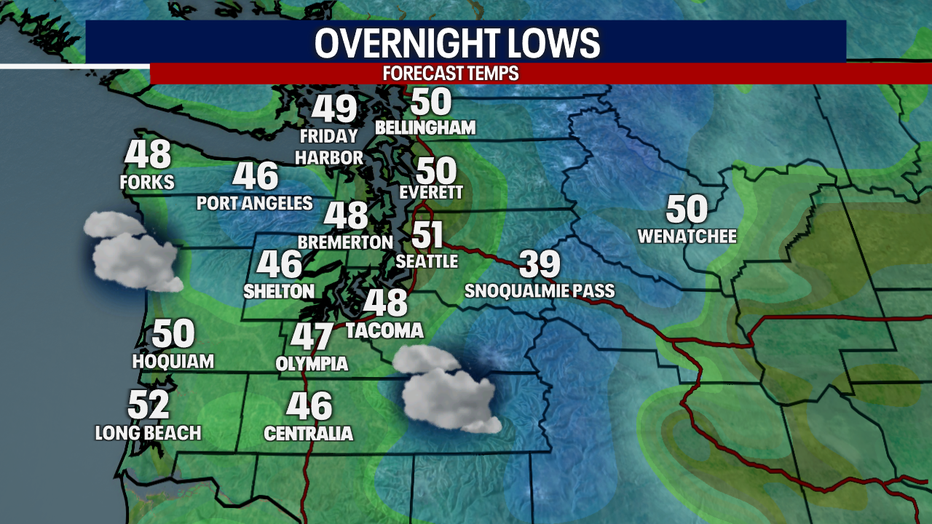
Showers will taper overnight with mostly cloudy skies and cooler temperatures, lows in the upper 40s to low 50s.
Clouds will start Thursday as most of the showers will have moved out overnight. Watch for areas of low clouds.
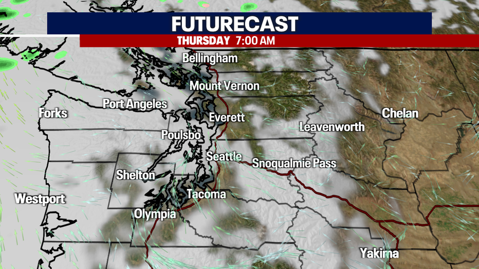
Clouds will start Thursday as most of the showers will have moved out overnight. Watch for areas of low clouds.
Highs tomorrow will be similar as we see more clouds and later showers, temperatures peaking in the upper 60s.
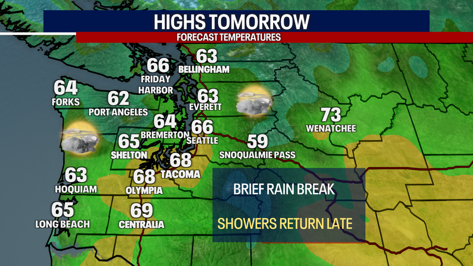
Highs tomorrow will be similar as we see more clouds and later showers, temperatures peaking in the upper 60s.
Rain returns Thursday afternoon/evening as the next frontal system moves through Western Washington.
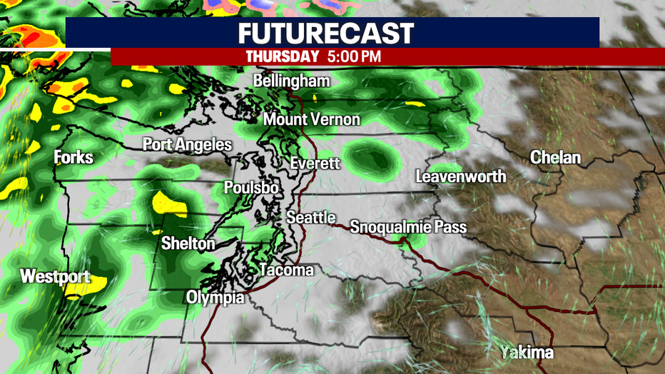
Rain returns Thursday afternoon/evening as the next frontal system moves through Western Washington.
Showers taper by Friday morning, with afternoon sunshine and cooler temperatures. Skies will remain dry with sunbreaks Saturday and Sunday with temperatures in the low 60s. Sunshine will continue into the beginning of the work week, with only a slight chance of showers by midweek.

Showers taper by Friday morning, with afternoon sunshine and cooler temperatures.

